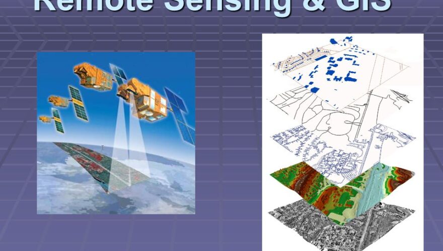
REMOTE SENSING AND GIS FOR PUBLIC HEALTH AND EPIDEMIOLOGY COURSE
Course Description
THE RATIONALE
Epidemiology seeks to determine associations between exposure risk and disease that are spatially dependent. Public health focuses on the health of populations rather than of individuals and focuses more on the prevention of health problems. These efforts fall naturally within the domain of problems requiring the use of spatial analysis as part of the solution, and GIS and other spatial analysis tools are therefore recognized as providing potentially transformational capabilities for Epidemiology and public health efforts.
Statistics are a mainstay in the toolkit of public health professionals. Human memory being what it is, however, even Public health professionals with reasonable statistical training, over the years, often forget the basics. If professionals are going to make sensible use of consultants, communicate effectively with funders, and understand others’ reports, then they often need at least a conceptual understanding of relatively complex, recently developed statistical techniques. This course aims to link common public health questions with appropriate statistical procedures, to offer a strong conceptual grounding in several important statistical procedures, and to describe how to interpret the results from the statistics in ways that are principled and will be persuasive to intended audiences using simple software tools.
Participants will acquire hands-on skills in the use of Geographic Information System (GIS) as a tool to capture, store, analyze, manage, and visualize disease cases data that is geographically linked. The participants will also acquire statistical data analysis skills.
THE COURSE OBJECTIVES:
By the end of this training, participants will be able to:
- To develop an understanding of the different components of a GIS and the role GIS plays in solving epidemiological and public health problems.
- To present to participants all data-related aspects of a GIS, such as the data models in GIS, data input, data editing, data visualization, metadata, and managing a spatial database.
- To carry out advanced analyses of geographical data with specific reference to epidemiological related issues
- To improve the data management and analysis skills of the participants
- To perform spatial and temporal epidemiological and public health analysis using GIS.
- Establish an understanding of how to work with spatial data and GIS techniques to solve epidemiology and public health problems.
- To introduce the participant to effective and efficient field health data collection techniques.
- To expose participants to data capture, input, manipulation, and display by GIS.
- To equip the participant with knowledge and skills to manage pandemics, prevent disease, and monitor quality to transform health.
- To demonstrate a participant’s use of GIS in mapping health facilities and sharing the information on online platforms for public access.
- To explain to the participants the role of GIS as a decision support system in public health.
THE COURSE OUTLINE
The course will cover the application of GIS in Public Health under the following:
MODULE 1: EPIDEMIOLOGY AND PUBLIC HEALTH CONCEPTS AND FRAMEWORKS
- Introduction to Epidemiology and Public Health Concepts
- Introduction to GIS in Epidemiology and Public Health Context
- Planning for a GIS system installation
- GIS Data Sources for Epidemiology and Public Health
- Working with GIS software
MODULE 2: GIS DATA MANAGEMENT IN EPIDEMIOLOGY AND PUBLIC HEALTH.
- Public health and epidemiology GIS Database creation
- Data Types and Data Sources in Epidemiology and Public Health
- Working with GIS Data
- Working with data from different sources (field data, databases, shapefiles, and spreadsheets)
- Facilitated Practical exercises in working with GIS Data
- Styling and symbolization
MODULE 3: SPATIAL MAPPING AND VISUALIZATION IN EPIDEMIOLOGY AND PUBLIC HEALTH
- Mapping Project activities
- GIS mapping of priority public health problems (HIV and AIDS, Malaria, Tuberculosis)
- GIS mapping of most-at-risk populations (MARPS)
- GIS Mapping of health facilities and health resources
MODULE 4: GIS FOR MONITORING IN EPIDEMIOLOGY AND PUBLIC HEALTH
- GIS in Disease transmission and progression mapping.
- GIS as a Decision Support System for Public Health Management (What, where, when, how, and why analysis – case studies).
- GIS in Environmental Management and Public Health (case studies or practical).
- Use of GIS in Epidemiology and Health-Related Disaster Management (case studies or practical).
- Shareable and interactive maps using open source APIs (Geoserver, OpenLayers, leaflets, google maps, CartoDB).
MODULE 5: PARTICIPATORY GIS IN PUBLIC HEALTH AND USE OF MOBILE GIS.
- Use of mobile GIS in health surveillance and assessments.
- Integrating GIS into Electronic Medical Records (case studies or practical?).
- Basic statistical data analysis for Epidemiology and Public health.
- Preparing data for analysis.
- Outlining and sorting data.
- Finding Records Using Criteria and Expressions.
- Data Quality reporting.
TARGET AUDIENCE
The course is targeted at individuals working with health data who have no experience using GIS but would like to learn how it can be applied in their work.
Delivery Method: Combines lectures, discussions, group exercises, and illustrations
Venue: GHANA
Duration: 1 week
Course Info
- Duration: 1 WEEK
- Language: English
- Prerequisites: No
- Course Capacity: 50
- Start Course: 06/20/2022
- Certificate: Yes
About Instructor
-
admin


There are no reviews yet.